Read on
Why you need to plan ahead
Diamond Head, the ridged cone that closes the east end of Waikīkī, is a State Monument and, since 1968, a National Natural Landmark. It is also the most popular walk in Honolulu, and its narrow switchbacks were never built for unlimited crowds. To manage that, the state now runs entry on a reservation system rather than open walk-up access.
The rule applies to visitors, not to residents. Anyone who is not a resident of Hawaiʻi must book an entry time in advance, and a separate parking reservation if arriving by car, before heading to the trailhead. Turning up without a booking is not something to count on.
The booking is made through the state parks reservation system online, and it is worth doing as soon as a Diamond Head morning is fixed in the itinerary, since specific arrival windows are involved. For the mechanics of the site and how far ahead to book, see Booking Ahead.
The English name is only from 1825, when British sailors found sparkling calcite crystals on the slopes, mistook them for diamonds and called the place Diamond Hill, later Diamond Head. In Hawaiian it is Lēʻahi, most likely lae, a brow or promontory, and ʻahi, the tuna, for a ridgeline once said to resemble a tuna's dorsal fin. There were never any diamonds.
Getting to the trailhead
The crater entrance sits on the inland side of the mountain, reached by road around its base. From Waikīkī it is a walk of some distance, or a short ride on TheBus, and either approach works well with an early start, before the day's heat settles over the exposed trail. For routes and how the bus system works, see Getting Around.
Drivers who book a parking reservation should check with the state parks reservation site exactly what that reservation covers, since it is tied to the same system as trail entry and works alongside it rather than separately.
Because entry times are timed, it helps to arrive with margin before the booked window, especially for anyone planning to combine the climb with time afterward in neighboring Kapiʻolani Park on the same morning.
The climb itself
The hike covers roughly eight tenths of a mile from the trailhead on the crater floor to the summit, gaining five hundred sixty feet along the way. It begins gently, on a paved path across the open crater floor, before the real climbing starts against the inner wall.
The path turns into a rockier trail of switchbacks, climbing steadily up the inside of the crater wall toward the rim. Near the top come a run of steep stairs and a lighted tunnel some two hundred twenty-five feet long, cut through the rock before the trail returns to daylight.
The final stretch climbs to the old fire control station built into the summit, where the trail ends at a lookout platform. The route was built in 1908 as part of the Army's coastal defense system, meant to let observers direct the fire of guns along the shore below.
The mountain itself, seen from inside the crater, looks nothing like the profile everyone recognizes from postcards and photographs; it is a dry, grassy bowl ringed by rock rather than the sharp silhouette rising above Waikīkī. That famous shape is a view from outside the crater, usually from the beach or the coast road, not from the trail itself.
What to bring and expect
State Parks advises good walking shoes, plenty of water, a hat and sunscreen, and setting aside roughly an hour and a half to two hours for the full round trip, including time at the summit before heading back down.
The trail is exposed for nearly its whole length, with little shade over the crater floor or the switchbacks above, and it grows hot as the day goes on. Going early, before the sun is high, is the advice from State Parks and makes the steep upper section easier to climb.
The summit is not accessible to visitors with limited mobility, given the stairs and tunnel near the top, though the facilities on the crater floor are. Anyone planning around mobility needs should check current conditions directly with State Parks before booking.
The view from the summit
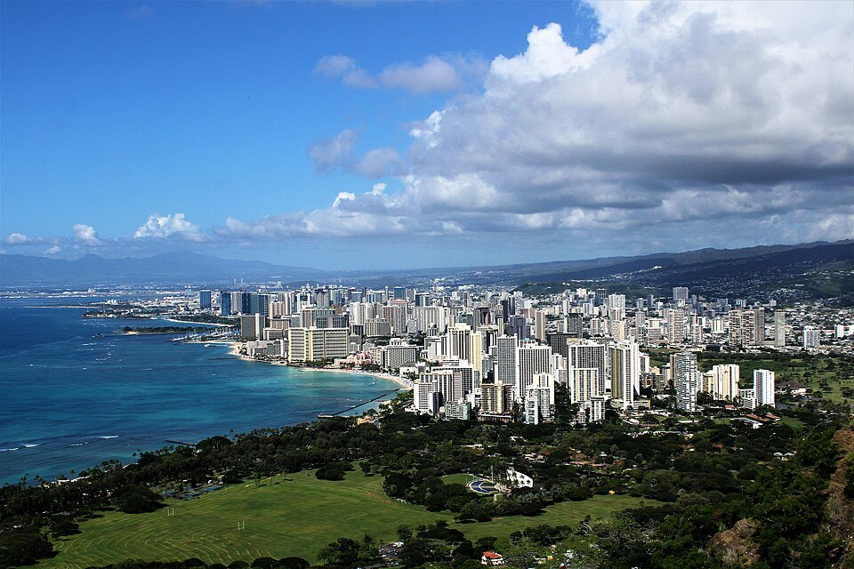
The reward for the climb is a panorama that explains Honolulu's layout better than any map. To the west lies the whole sweep of Waikīkī and downtown, running out to the harbor; to the north the view opens over Kapahulu and Kaimukī toward the Koʻolau ridge and Mānoa valley.
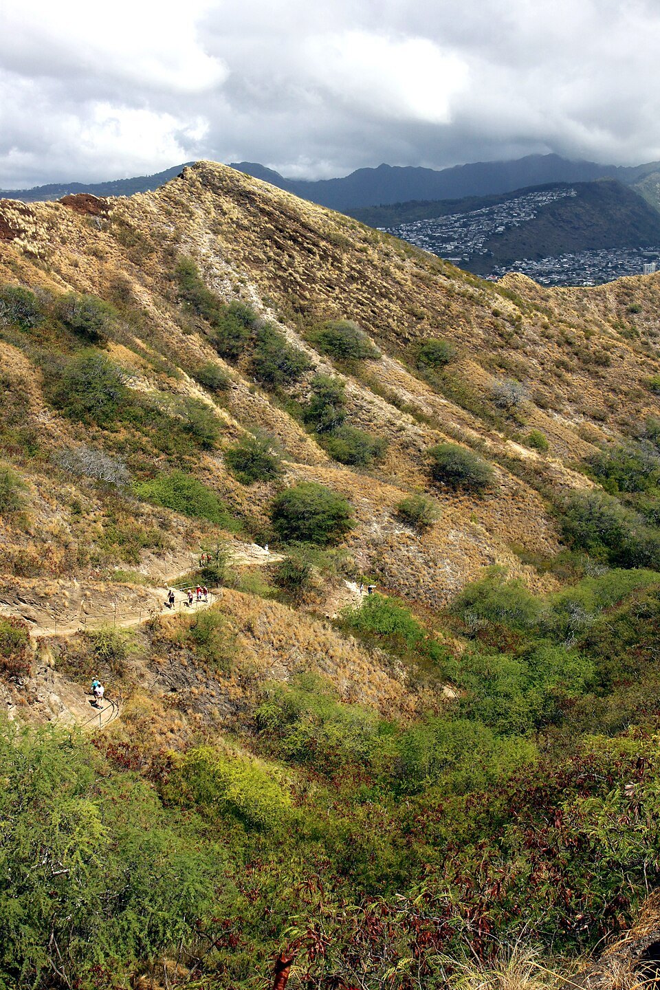
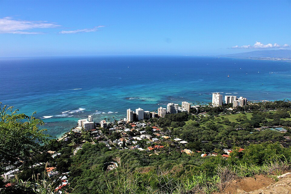
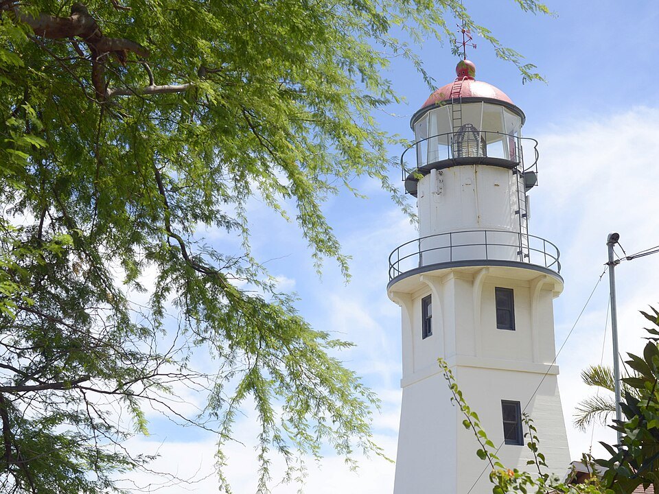
Below, on the seaward slope, the coast drops to a reef and to a lighthouse built in 1917, marking the point where the road curves around the base of the cone toward the sea.
Bunkers and pillboxes from the site's military years still stand along the rim, relics of the fire control station the trail was built to serve, along with antennas belonging to installations still in use, a reminder that parts of the crater remain closed to visitors.
The panorama has appeared in decades of film and television set in Honolulu, from a 1963 film named for the mountain to two versions each of Hawaii Five-O and Magnum, P.I. Almost every one of these shows the classic view from Waikīkī toward the mountain, not the view outward from its summit, which rarely appears on screen.
A fort inside a volcano
Diamond Head is a tuff cone, formed when rising magma met water in an explosive eruption that threw out ash, later hardened into the rock called tuff. It is far younger than the Koʻolau range that shaped this side of Oʻahu some two million six hundred thousand years ago; Diamond Head itself formed only about four hundred thousand to five hundred thousand years ago.
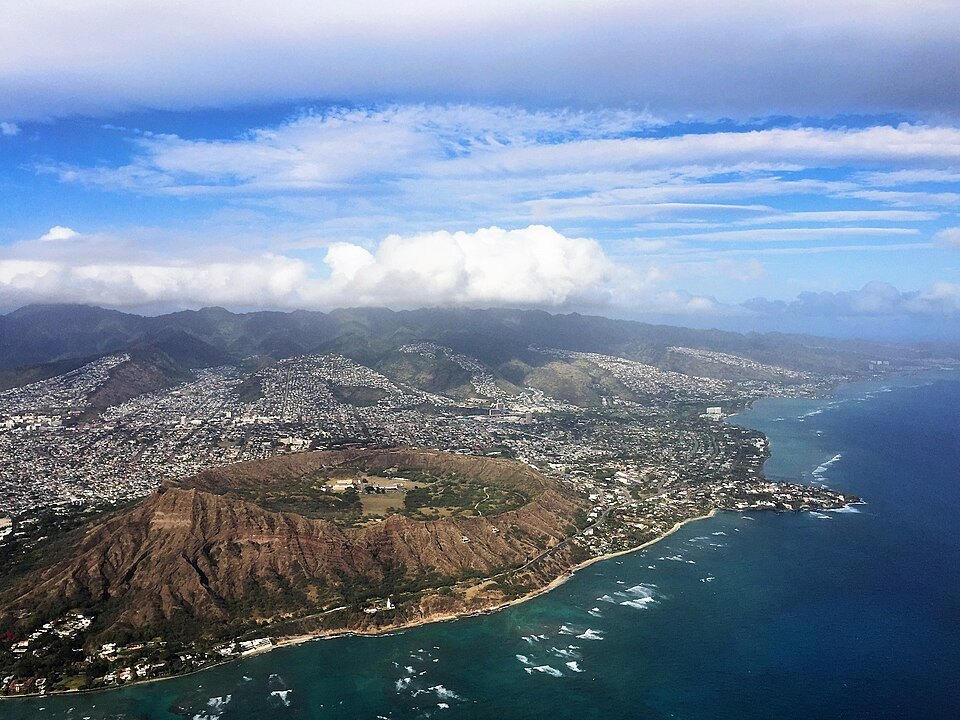
The crater was the first military reservation of the United States in Hawaiʻi, known as Fort Ruger, and in the early 1900s the summit served as a lookout over Waikīkī and the south shore, a position the Army valued for its view.
A National Guard emergency operations center and the state's civil defense headquarters still occupy parts of the crater, along with antennas on the rim, and these areas remain closed to visitors. In the 1960s and 1970s the crater floor also hosted a series of large music festivals, sometimes called Hawaiian Woodstock.
Before or after the climb
The dry plain below the western slope was chosen by King Kalākaua in the 1870s for a horse-racing course, and in 1877 it became Kapiʻolani Park, whose trees and open lawns sit close enough to the crater entrance to link the two in one morning. See Kapiʻolani Park and the Natatorium.
On the seaward side, the road curves around the base of the cone past the 1917 lighthouse and the cliffs above the reef, with lookouts over the surf, the stretch where the mountain's familiar photographs are usually taken.
A practical order is to climb while the trail is still cool, then descend into the shade of the park's trees, leaving the rest of the morning free for the flatter ground and shoreline at the Diamond Head end of Waikīkī.
Diamond Head has been sung about for more than a century, from Kaimana Hila, Charles King's Hawaiian-language classic of 1916, to the instrumental recorded by The Ventures in 1964, which became the first single in Japan to sell a million copies. The Beach Boys later recorded a song of the same name, and in 1952 the crater appeared on an air mail stamp issued for sending orchids to the mainland.
More from the journal
- Getting AroundDo you need a car in Honolulu?Why most visitors can see Honolulu without a car, what TheBus, Skyline, bikes and taxis cover, where a car makes sense, and how to rent one for just the days you need it.Read the piece
- Getting HereHow do you get from Honolulu airport to Waikīkī without a car?By bus, by shuttle, by taxi or ride app, or partly by the new Skyline rail line: how each way from the airport to Waikīkī works, what to do with your luggage, and which suits whom.Read the piece
- The OceanWhere can beginners swim safely in Honolulu?The calmest water in the city for children and weak swimmers, what makes each beach easy or tricky, how to read the lifeguards' signs, and the reef, jellyfish and sunscreen rules to know before you get in.Read the piece