Home · Sights · Diamond Head (Lēʻahi)
Diamond Head (Lēʻahi)
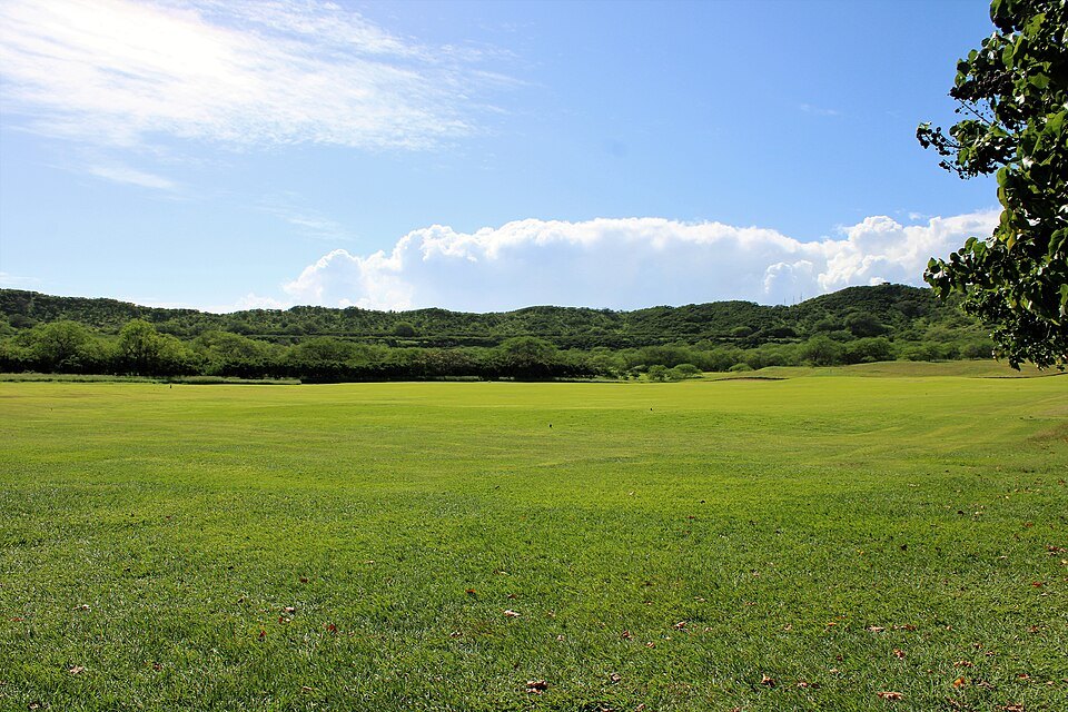
- iThe crater floorA wide grassy bowl inside the rim, with the visitor center, where the trail begins.
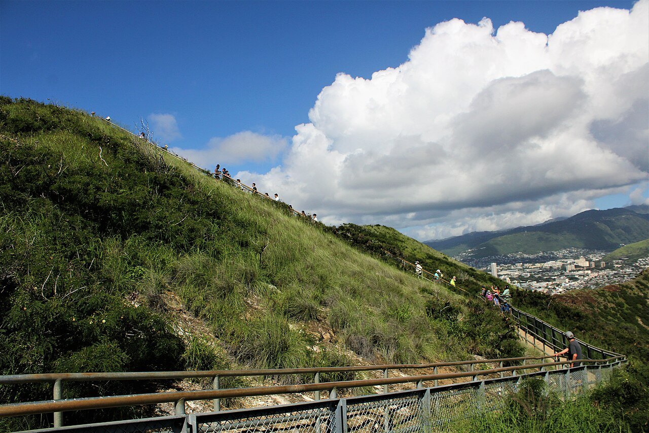
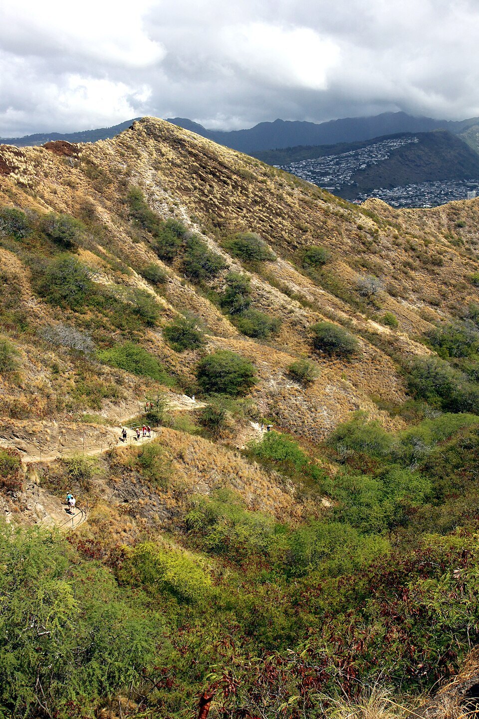
- iiThe switchbacksThe first part of the trail, a paved and then rocky path zigzagging up the inside of the crater wall.
- iiiThe stairs and the tunnelSteep flights of steps and a lighted tunnel about 225 feet long near the top.
- ivThe fire control stationA concrete bunker on the summit, built to direct coastal artillery, now the lookout.
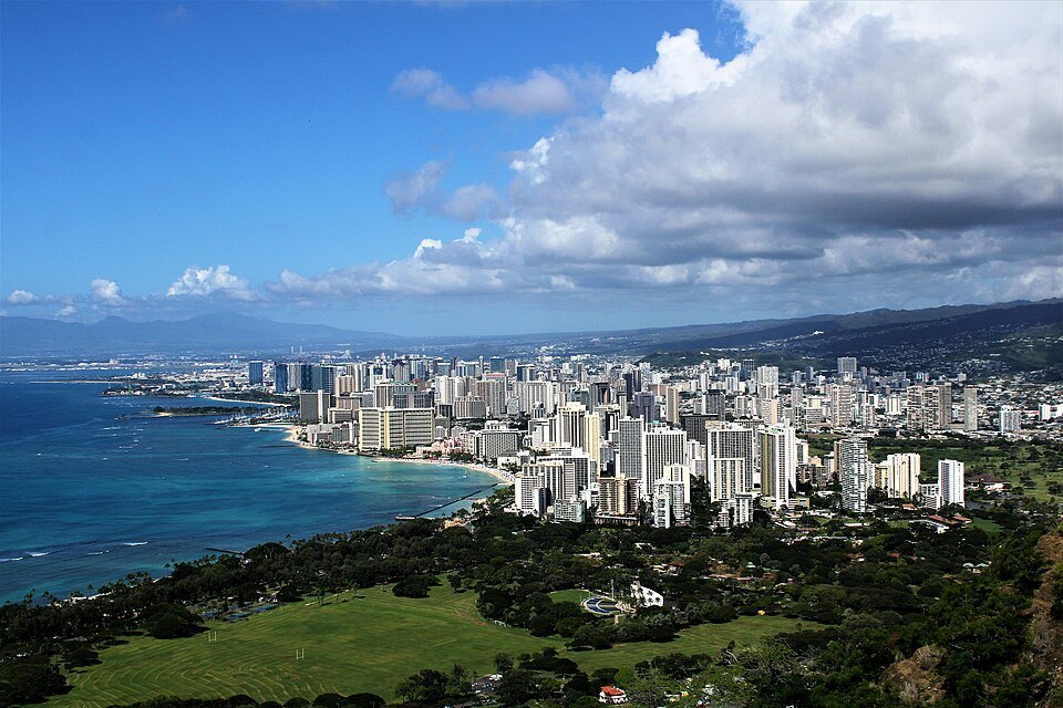
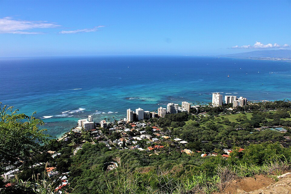
- vThe summit viewWaikīkī, downtown and the Koʻolau ridge to the west, the reef and the ocean below.
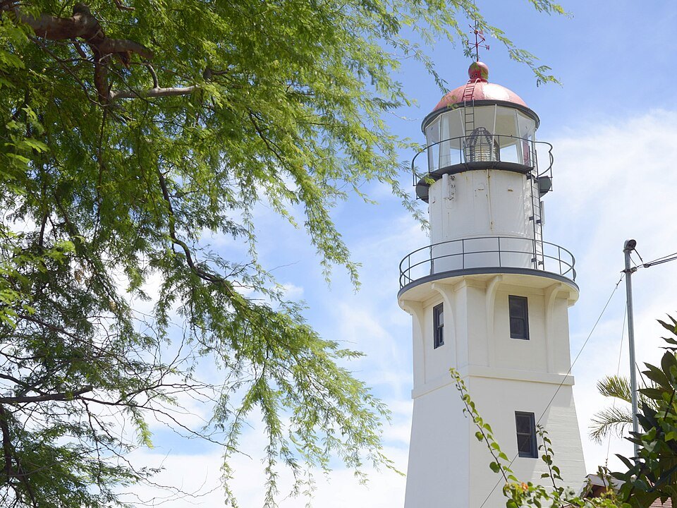
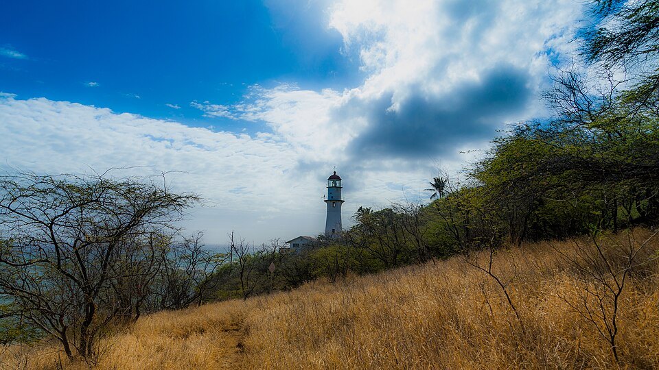
- viThe lighthouseA navigational lighthouse of 1917 on the seaward slope, seen from the trail and the coast road.
Reading the place
Why it matters
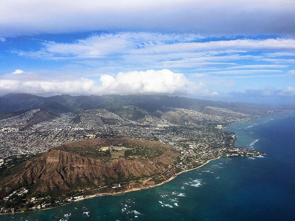
Diamond Head is the shape everyone knows from Honolulu: the broad, ridged cone at the east end of Waikīkī Beach, seen behind the hotels, the surfers and the palms in countless photographs and films. It is a State Monument, and since 1968 a National Natural Landmark. Climbing it is the most popular walk in the city, and the view from the top explains Honolulu's layout better than any map: the reef, the beach, the towers, and the green ridges of the Koʻolau behind.
It is also a reminder that the city stands on volcanoes. Diamond Head belongs to the Honolulu Volcanic Series, a set of younger cones and vents that also made Punchbowl and other landmarks on the island.
Two names
In Hawaiian the mountain is Lēʻahi, most likely from lae, a brow or promontory, and ʻahi, the tuna: the ridgeline was said to look like the dorsal fin of a tuna. The English name came in 1825, when British sailors found sparkling calcite crystals in the sand on its slopes, took them for diamonds and called the place Diamond Hill. The hill became Diamond Head, from headland. The Hawaiian rendering Kaimana Hila, “Diamond Hill,” is the title of a well-known song of 1916 by Charles King.
How the crater formed
Diamond Head is a tuff cone: a crater made when rising magma met water and exploded, throwing out ash that settled and hardened into the rock called tuff. It formed long after the Koʻolau volcano, which built this side of Oʻahu, had gone quiet; the Koʻolau range is about 2.6 million years old, and Diamond Head only some 400,000 to 500,000. The whole landmark, crater and outer slopes together, covers more than 475 acres.
A fort in a volcano
The crater was the first military reservation of the United States in Hawaiʻi, Fort Ruger, and the summit was a strategic lookout in the early 1900s because of its view over Waikīkī and the south shore. The trail you walk was built in 1908 as part of the Army's coastal defense system, to reach a fire control station at the summit that would direct the fire of the coastal guns in case of war. Bunkers and pillboxes still stand on the rim.
Parts of the crater are still used by the government and closed to the public. A National Guard emergency operations center and the state's civil defense headquarters remain inside, and antennas stand on the rim. In the 1960s and 1970s the crater floor also held a series of large music festivals, sometimes called Hawaiian Woodstock.
The trail
The hike runs 0.8 mile from the trailhead on the crater floor to the summit and climbs 560 feet. It starts gently, on a paved path, then turns into a rocky trail of switchbacks up the inside of the crater wall. Near the top come steep stairs and a lighted tunnel about 225 feet long, and then the last climb to the fire control station, where you come out onto the lookout.
From the summit you look west over the whole of Waikīkī and downtown to the harbor, north over Kapahulu and Kaimukī to the Koʻolau ridge and Mānoa valley, and down onto the reef and the lighthouse of 1917 on the seaward slope.
The mountain in song
Diamond Head has been sung about for more than a century. Charles King's Kaimana Hila of 1916 is a Hawaiian-language classic. In 1964 the instrumental “Diamond Head,” written by Danny Hamilton and recorded by The Ventures, became an international hit, and in Japan it was the first single to sell a million copies. The Beach Boys recorded a song of the same name.
In 1952 the crater appeared on an air mail stamp issued for sending orchids to the mainland, and television kept it in the background for decades, as the scenic backdrop of shows set in Hawaiʻi.
At the foot of the mountain
The dry plain below the western slope was chosen by King Kalākaua in the 1870s for a horse-racing course, and in 1877 it became Kapiʻolani Park. On the seaward side, the road curves around the base of the cone past the lighthouse of 1917 and the cliffs above the reef, with lookouts over the surf; the photographs of the lighthouse and the rocky shore on this page were taken there.
From the park you can walk to the crater entrance, so a morning can join the two: the climb while it is cool, and then the shade of the park's trees and a swim at the Diamond Head end of Waikīkī.
How to visit
You need a reservation. Visitors who are not Hawaiʻi residents must book an entry time, and a parking reservation if they drive in, in advance through the state parks reservation site; residents with valid identification are exempt. See booking ahead. Walk-up entry cannot be counted on.
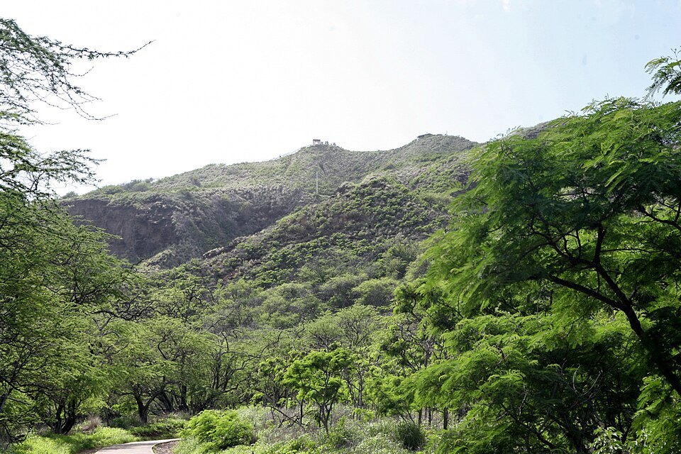
State Parks advises good walking shoes, water, a hat and sunscreen, and planning about an hour and a half to two hours for the round trip. The trail is exposed, hot for most of the day and steep near the top, and the summit is not accessible to people with limited mobility, though the crater floor facilities are. Go early in the day, when it is cooler.
From Waikīkī the crater entrance is a walk of some distance or a short bus ride; getting around explains TheBus.
Honest notes
There were never any diamonds. And the Diamond Head on film, from the 1963 film of that name to two versions each of Hawaii Five-O and Magnum, P.I., is almost always the view from Waikīkī. The mountain itself, from inside the crater, looks nothing like that famous profile; it is a dry, grassy bowl ringed by rock.
Nearby
- NearbyKapiʻolani Park and the NatatoriumThree hundred acres of lawn and shade at the foot of Diamond Head, dedicated in 1877 and named for Queen Kapiʻolani, with a crumbling war memorial of 1927 on the shore and the quietest beaches of Waikīkī.Read the page
- NearbyWaikīkī Beach and Kalākaua AvenueEight beaches strung between the Ala Wai Canal and Diamond Head, a long rolling surf break that taught the world to ride a longboard, and behind the sand the avenue named for a king.Read the page
- NearbyThe Moana and the Royal HawaiianWaikīkī's two historic hotels: the white colonnaded Moana of 1901, the first hotel on the beach, and the pink Spanish-Moorish Royal Hawaiian of 1927, built for the passengers of the great ocean liners.Read the page